Land & Environmental Agency Professional Website Template
Stratum is a sidebar companion landing page built for geological survey organizations that fund field science through donor support. It combines a data-first storytelling approach with a structured donation flow, displaying impact numbers, named survey narratives, and tiered giving options. The design draws from a topographic map aesthetic to earn trust with conservation funders, water boards, and earth-science donors.
by Rocket studio
Quick summary
Stratum is a fundraising landing page built for geological survey organizations. It leads with enormous impact numbers, moves through data-anchored field narratives, and closes with a clear donation form. Every inch of the layout is designed to help conservation land trusts, municipal water boards, and individual donors understand exactly what their funding makes possible underground.
Who this template is for
This landing page is built for organizations that do serious field geology and need donors to fund it. It speaks directly to audiences who already respect science and want to see their contribution mapped to a real outcome.
- Conservation land trusts protecting vulnerable acreage and watersheds
- Municipal water boards investigating contamination plumes and subsurface geology
- Individual donors with a deep connection to earth science and field research
What problem this template solves
Most fundraising pages for scientific organizations bury the impact in dense text. Donors leave without understanding what the work actually involves or why it matters. This template solves that by leading with data before the story, so every visitor grasps the scale of the survey work before they reach the donation form.
- Donors cannot determine the value of a survey from a generic deliverables list
- The connection between a gift and a specific field outcome is rarely displayed clearly
- Recurring giving paths are often framed as transactions rather than ongoing relationships
What you get with this template
The template is built around a sidebar companion layout with a persistent navigation panel and a running donation thermometer. The main column scrolls through survey content on a parchment white field, while the sidebar stays anchored so the call to action is always within reach.
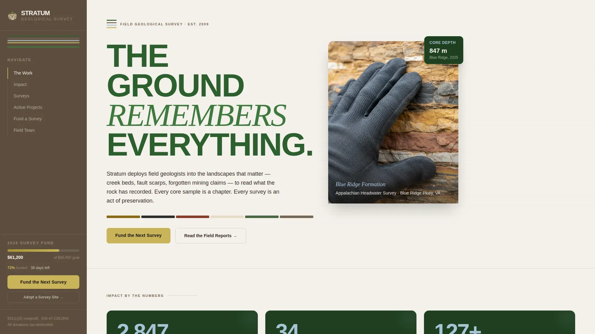
- A hero section with giant stacked headline type and a static geological photograph
- A three-stat impact row with scroll-triggered count-up numbers displayed in glacial blue cards
- A tiered donation form with three preset amounts and a recurring "Adopt a Survey Site" path
Feature list
This landing page is built for the full fundraising process, from first impression to completed donation.
Giant Headline Hero with Static Image
The header displays the headline "THE GROUND / REMEMBERS / EVERYTHING" in enormous stacked type, set in old-growth canopy green against a parchment field. To the right, a single high-resolution image shows a geologist's gloved hand pressed against a cross-sectioned rock face, with strata bands in ochre, charcoal, rust, and cream clearly visible. No animation is applied. The stillness communicates the weight of the study.
Stats-First Impact Row
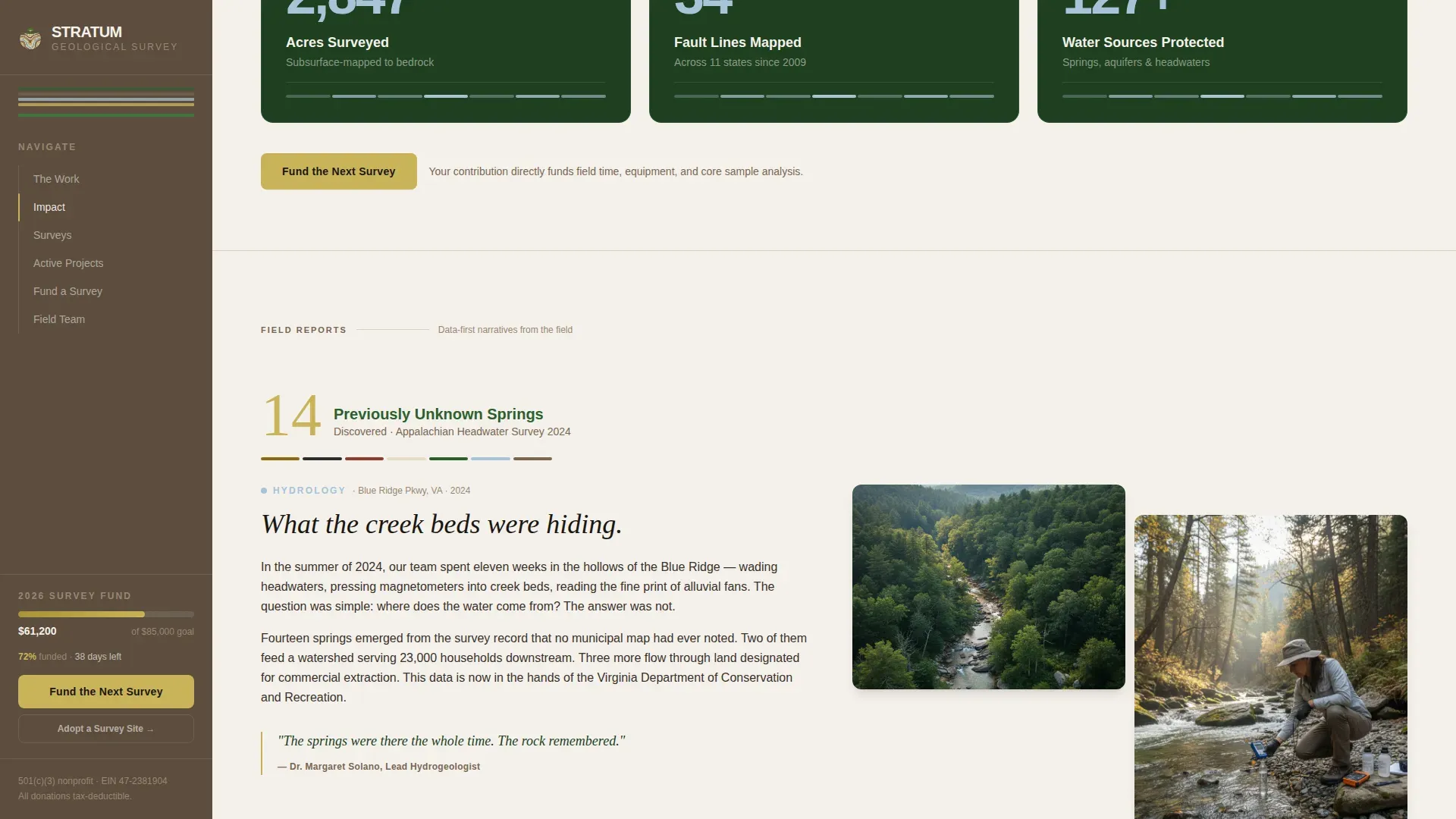
Three oversized numbers are displayed immediately below the hero: acres surveyed, fault lines mapped, and water sources protected. Each figure counts up on scroll-enter using an intersection-based trigger. The numbers are rendered in glacial blue against dark canopy green cards, giving donors a quantified report of field progress before any narrative begins.
Data-Anchored Survey Narratives
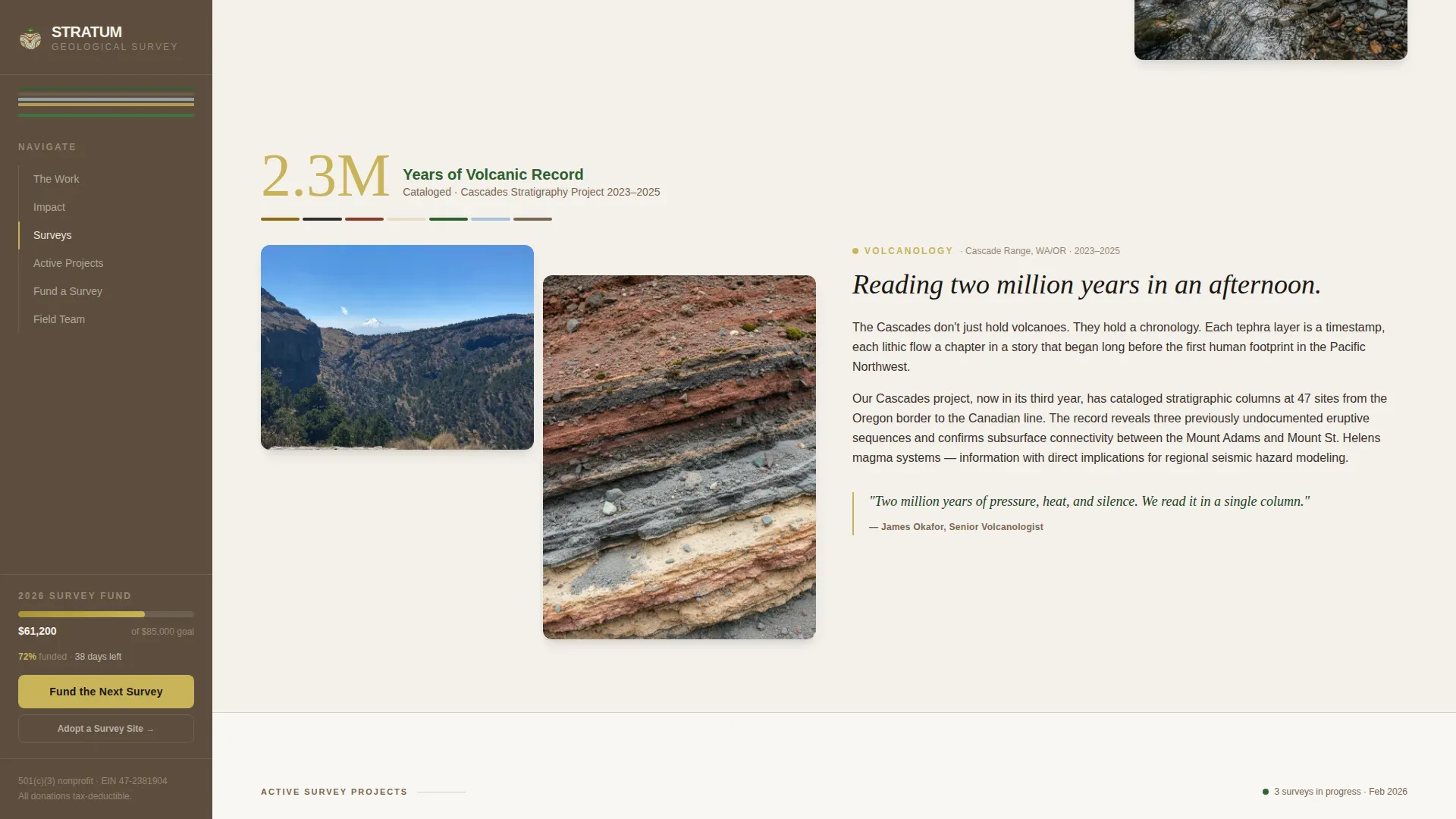
Each narrative section opens with a specific data point before revealing the story behind it. For example, a section called "14 previously unknown springs discovered" leads into a photo essay on the Appalachian headwater survey. This approach trains the visitor to expect a number, then lean in for the context. It mirrors the process geologists use when investigating strata: read the record, then interpret it.
Structured Donation Form
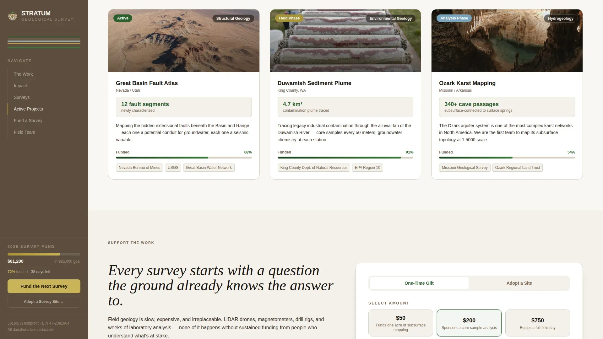
The donation form offers three preset giving tiers: fifty dollars funds one acre of subsurface mapping, two hundred dollars sponsors a core sample analysis, and seven hundred fifty dollars equips a full field day. A custom amount field sits alongside the presets. A secondary path labeled "Adopt a Survey Site" frames recurring monthly giving as an ongoing relationship with a specific landscape.
Persistent Sidebar with Donation Thermometer
The sidebar holds persistent navigation and a live donation thermometer displayed against mudstone brown. The primary call-to-action button reading "Fund the Next Survey" is fixed in the sidebar, ensuring it is always visible as the visitor scrolls through survey narratives and project cards.
Active Project Cards
Geographic project cards show named survey sites with real data and current status. Each card connects a specific location to the field work being conducted there, helping donors understand which site their contribution will support and what data the team expects to report.
Page sections overview
| Section | Purpose |
|---|---|
| Hero headline image | Establishes tone and field credibility with stacked type and geological photograph |
| Stats impact row | Displays three scroll-triggered numbers to anchor donor understanding immediately |
| Survey narrative essays | Pairs a data point with a photo-led field story for each major project |
| Active project cards | Shows named survey sites with status and data context |
| Donation form tiers | Presents three giving levels with a recurring monthly donor path |
| Sidebar thermometer panel | Keeps the funding goal and primary call to action visible throughout scroll |
| Footer links | Provides privacy, terms, and social links in a minimal developer-style footer |
Design & branding system
The visual identity follows a Forest Trust color system that feels like a topographic map left on the dashboard of a field truck. Every color has a practical reference point in the physical landscape, which makes the page feel grounded and trusted rather than polished and generic.
- Old-growth canopy green (#2D5F2E) for headlines and primary type, mudstone brown (#7A6652) for the sidebar background, and parchment white (#F4F1EB) for the main content field
- Glacial meltwater blue (#A8C4D8) for statistics and data callouts, lichen gold (#C9B458) for donation buttons and highlighted figures
- Bricolage Grotesque for sans-serif body text paired with Instrument Serif for accent headings, mirroring a field notebook aesthetic
Mobile & speed optimization
The template is desktop-first by design. The sidebar companion layout requires a wider viewport to display correctly. On smaller screens, the sidebar collapses so the core content and donation form remain fully usable.
- Desktop layout displays the sidebar and main column side by side for full fundraising context
- Tablet and mobile views collapse the sidebar, surfacing the donation thermometer and call to action inline
- Static sections are built as server components; the sidebar, donation form, and scroll counters run as client components
How this template helps you convert
The page is designed to move a donor from curiosity to commitment by building understanding at each scroll step.
- The stats row earns attention immediately by displaying specific, verifiable field numbers before any ask is made, establishing credibility through the data itself.
- The narrative sections deepen trust by connecting each statistic to a named project and a photograph, so donors feel they are funding a real place rather than an abstract process.
- The persistent sidebar keeps the "Fund the Next Survey" button displayed at all times, while the tiered form makes it easy for any donor to find an amount that matches their level of commitment.
Other information about this template
This template is listed as the Stratum Fund the Field Geological Survey Landing Page Template in the marketplace. It is built at the intersection of earth science communication and donation-optimized design, making it suitable for scientific nonprofits that need to bridge technical field data with compelling fundraising narratives.
- The study of stratigraphy shows that strata are unique records of meaningful events in the history of the earth. Geological maps are often overlaid on topographic maps to give a complete understanding of how surface landforms relate to the underlying rocks below.
- Geological maps are vital in finding and developing geological resources including water, gravel, and groundwater. They are produced at various scales, and map scale directly determines the level of detail captured.
- Sedimentary strata are formed from the accumulation and compaction of mineral and organic particles layered over time. Sediment transport processes influence long-term stratigraphic sequences preserved in the geologic record.
- The preservation of stratotypes is important because they can be threatened by human activities such as urban development. Three-dimensional geological modeling assists geologists in decision-making, including underground space evaluation and geological hazard prevention.
- Geological surveys often involve ongoing revisions and updates to reflect new data. Digital versions of geologic maps have made those updates faster and more accessible for practitioners across all project scales.
Theme
Directory & Discovery
Creative direction
Stats-First Impact
Color system
Forest Trust
Style
Sidebar Companion
Direction
Donation/Fundraising
Page Sections
Giant Headline Hero with Geological Image
Stats-first Impact Row
Data-anchored Survey Narratives
Tiered Donation Form with Recurring Path
Persistent Sidebar with Live Thermometer
Related questions
Who is the ideal organization to use this template?
Can the donation tiers and amounts be changed?
Does this template support recurring donations?
Is this template suitable for mobile visitors?
How is the sidebar donation thermometer set up?