Soil & Water Conservation Professional Website Template
Levee is a hero-dominant landing page template built for flood control engineering firms. It leads with a full-viewport animated watershed map, slams hard engineering statistics into view on scroll, and drives qualified prospects toward a scoping consultation. The dark command-center aesthetic signals technical authority before a single word of copy is read.
by Rocket studio
Quick summary
Levee is a single-page template designed for civil and hydraulic engineering firms specializing in flood control. It opens on a live-looking watershed map, escalates through massive typographic statistics, and closes on a direct call to action. Every section is built to convert municipal directors, county engineers, and land developers into consultation-ready prospects.
Who this template is for
This template is built for professional firms that need to communicate technical credibility to a demanding, data-literate audience. It speaks the language of public infrastructure decision-makers who have no patience for vague marketing language.
- Municipal public works directors reviewing outdated Federal Emergency Management Agency floodplain maps
- County engineers managing undersized culverts against revised climate projections
- Land developers who need Conditional Letter of Map Revision (CLOMR) and Letter of Map Revision (LOMR) approvals before site grading begins
What problem this template solves
Flood control engineering firms often struggle to translate deep technical expertise into a first impression that earns trust fast. A generic template cannot carry the weight of a zero-failure track record or a 19-storm-season record of approved FEMA map revisions.
- Prospects arrive skeptical and leave without contacting anyone, because the page looks like every other civil engineering site
- Hard proof points like detention capacity volumes and FEMA approval counts get buried in walls of body text
- There is no clear path from browsing to booking a scoping conversation
What you get with this template
This template delivers a fully structured, single-page layout designed around a hero-dominant flow. Content sections are sequenced to move a visitor from awe to evidence to action without friction.
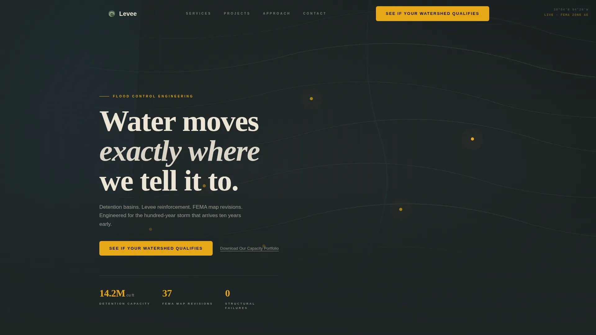
- A full-viewport map hero with animated flood inundation overlays and amber call-to-action pinned to the bottom
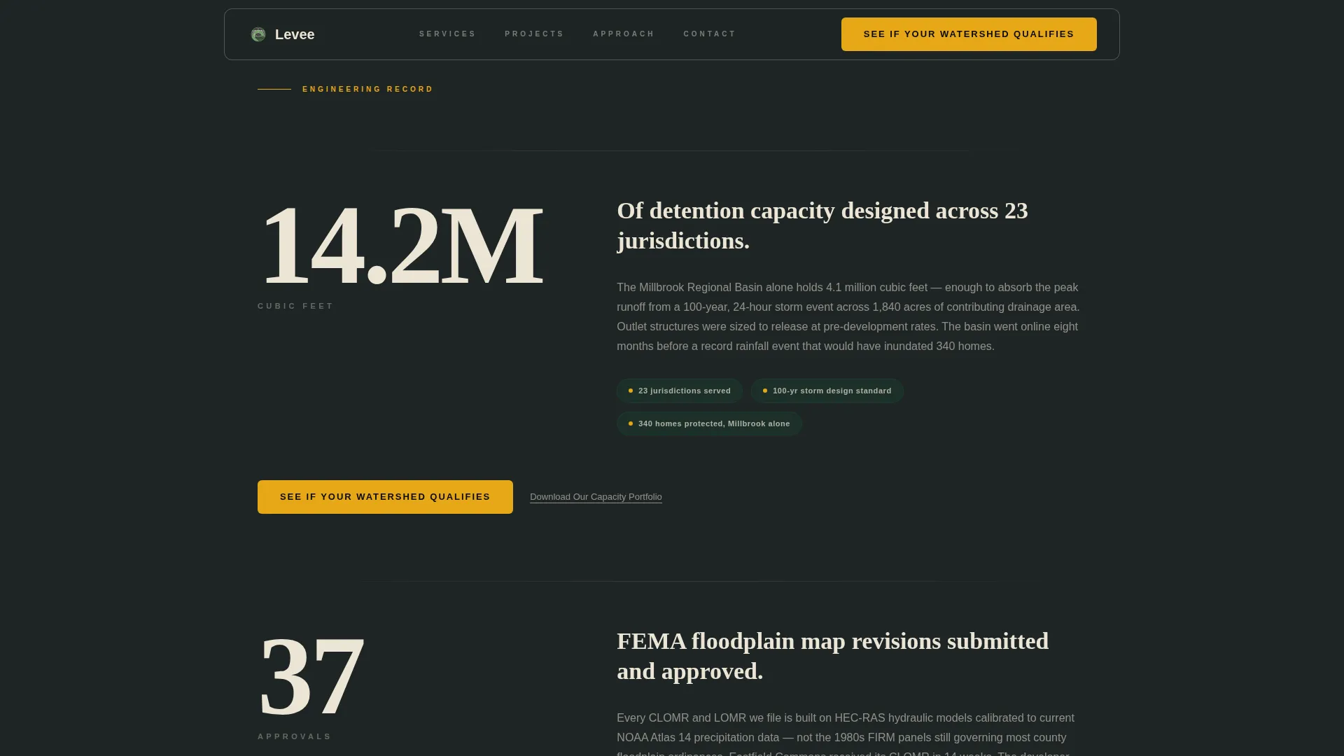
- A stats-first impact section with three landmark engineering figures rendered in oversized serif numerics
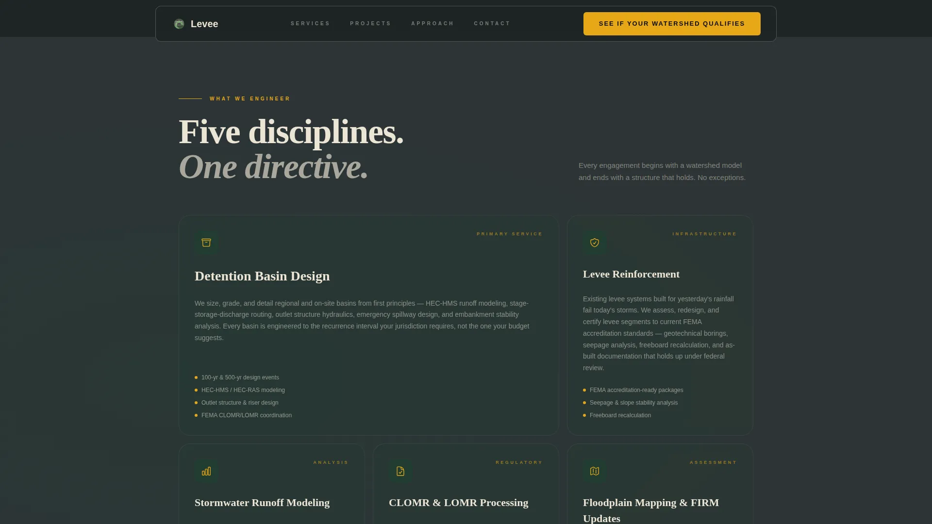
- An asymmetric services bento grid, three project evidence cards, a repeated call-to-action strip, and a linear single-row footer
Feature list
This template is built around deliberate design and interaction decisions drawn directly from the source brief. Each feature serves a specific job in the conversion sequence.
Animated Watershed Map Hero
The hero fills the entire viewport with a dark topographic contour map. Completed project sites pulse in amber dots along river corridors. A translucent blue flood inundation overlay sweeps across the map on load, then recedes to reveal protected zones in canopy green. Cursor-reactive parallax keeps the map feeling alive as the visitor explores.
Stats-First Impact Section
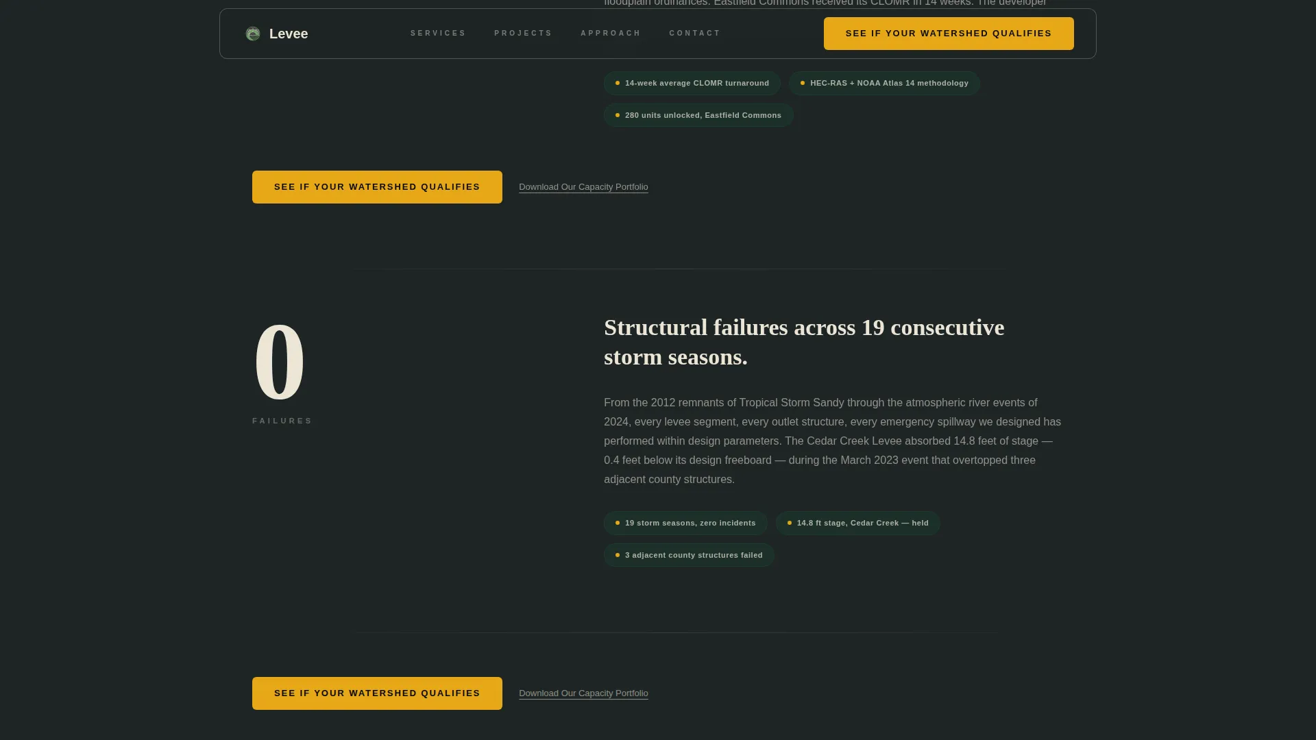
Three oversized engineering statistics slam into view on scroll using GSAP-powered counter animations. Each number is set in a large serif typeface and anchored by a short project narrative beneath it. The sequence reads from raw volume to approval record to zero-failure history, building trust with every line.
Services Bento Grid
Three core services sit inside an asymmetric bento grid layout. Detention basin design, levee reinforcement, and stormwater runoff modeling each occupy a distinct card. The layout makes it easy to scan service scope without reading paragraphs.
Project Evidence Cards
Three case study cards present real project context including basin dimensions, recurrence interval engineering targets, and the communities each project protects. Hover states animate on desktop to surface additional detail, rewarding engaged readers.
Repeating Call-to-Action Strip
The primary call-to-action button appears first at the base of the hero map and repeats after every second statistics block. A secondary text link offers a portfolio download for top-of-funnel visitors who are not yet ready to talk. No form appears on this page; all clicks route to a dedicated scoping questionnaire.
FAQ Accordion
An interactive accordion component handles common prospect questions without cluttering the main page flow. It keeps the page scannable while still answering the technical objections that delay a first conversation.
Page sections overview
| Section | Purpose |
|---|---|
| Hero Watershed Map | Establish authority with animated topographic display and primary call to action |
| Stats Impact Block | Slam three landmark engineering figures into view with project narratives |
| Services Bento Grid | Present detention basins, levee reinforcement, and stormwater modeling at a glance |
| Project Evidence Cards | Deliver case study proof with basin specs and protected community context |
| Call-to-Action Strip | Repeat primary button and surface portfolio download link |
| Linear Footer | Close with single-row navigation and contact anchor |
Design & branding system
The visual identity follows a Service Utility theme built on a Rainforest color palette. The overall feel is a command-center screen left open during a storm event, not a polished brochure.
- Background layers use storm-sky charcoal (#2D3436) and deep canopy green (#1B4332); body text runs in weathered off-white (#ECE5D5) against dark fields
- Emergency-channel amber (#E6A817) appears exclusively on call-to-action buttons and live data callouts, reserving it as a true visual signal
- Typography pairs DM Sans for body copy and labels with Fraunces serif numerics for the oversized statistics, combining data-dense utility with heavyweight impact
Mobile & speed optimization
The template is built desktop-first to match the large-monitor workflows of operations center users, but remains fully responsive across screen sizes. Performance-conscious techniques are baked into the animation architecture.
- GSAP ScrollTrigger and IntersectionObserver power stat counters and scroll-triggered slam animations using GPU-accelerated transforms
- SVG topographic contours and the flood sweep overlay are engineered to animate without layout reflow, keeping the map hero smooth on larger displays
- Responsive breakpoints ensure the bento grid, evidence cards, and call-to-action strips restack cleanly on tablet and mobile viewports
How this template helps you convert
Every layout decision in this template pushes a qualified visitor toward one action: requesting a watershed scoping consultation. The page is structured as a deliberate escalation from proof to ask.
- The hero map and amber call-to-action button create an immediate, specific prompt before the visitor has read a single body paragraph, capturing high-intent visitors who already know what they need.
- The repeating call-to-action strip ensures the primary button reappears after every second statistics block, so a visitor who pauses to read project narratives is always one click away from the consultation questionnaire.
- The secondary portfolio download link captures engineers who are in research mode, keeping them engaged with the firm's work while they move toward a decision at their own pace.
Other information about this template
This template is categorized under Agriculture and Environment, with a subcategory focus on Soil and Water Conservation and a niche alignment to Flood Control Engineering. It was designed around a USA localization context, using imperial measurements and references to federal agency processes including FEMA map amendments and CLOMR and LOMR approval workflows.
- The intersection match score of 13 reflects a high alignment between the Service Utility theme, the Stats-First Impact creative direction, the Map-Based header concept, and the Click-Through landing page direction
- Animation complexity is intentionally high, with SVG topo contours, pulsing amber dots, a flood inundation sweep, GSAP stat counters, and scroll-triggered slam animations all specified in the source brief
- The scoping questionnaire linked from the call to action asks for jurisdiction, drainage area size, and whether the project involves new development or a retrofit, qualifying leads before any direct conversation begins
Theme
Service Utility
Creative direction
Stats-First Impact
Color system
Rainforest
Style
Hero-Dominant (90/10)
Direction
Click-Through
Page Sections
Animated Watershed Map Hero
Stats-first Impact Section
Asymmetric Services Bento Grid
Project Evidence Cards
Repeating Call-to-action Strip
FAQ Accordion Component
Related questions
Who is this template designed for?
Does this template include a contact form on the page?
What animations and interactions are built into this template?
Can I replace the statistics and case study content with my firm's own data?
What devices does this template support?