Soil & Water Conservation Directory Website Template
Shoreline is a single-column landing page template built for coastal erosion management practices. It guides municipal directors, federal land managers, and resort operators through a scroll-driven, decade-long project timeline. Warm mineral colors, an aerial map header with pulsing project pins, and a dual-path lead capture system make this template a focused B2B conversion tool for living shoreline services.
by Rocket studio
Quick summary
Shoreline is a single-column flow landing page template for coastal erosion management professionals. It walks visitors through a scroll-linked project timeline from raw erosion data to a decade of measurable recovery. The design uses warm stone tones and botanical textures to reflect the living shoreline approach it represents. Two lead capture paths serve both ready-to-act buyers and earlier-stage researchers.
Who this template is for
This template is built for environmental engineering practices and land stabilization consultancies that work directly with institutional clients. The layout and conversion flow are calibrated for B2B contexts where trust and evidence come before any sales ask.
- Municipal public-works directors managing coastal road infrastructure
- Federal land managers balancing habitat restoration mandates with budget cycles
- Resort and hospitality operators protecting beachfront assets across multiple seasons
What problem this template solves
Coastal erosion management services are hard to sell without visible proof. Decision-makers in public agencies and resort operations need evidence, not promises, before they can authorize a site assessment or budget a partnership conversation. A generic service page cannot do that work.
- Static layouts cannot show the gradual, year-by-year nature of shoreline recovery
- Institutional buyers need credible data and named project examples before committing
- Two-speed buyer journeys require separate entry points for ready leads and research-stage contacts
What you get with this template
You get a fully structured single-column landing page with every section designed specifically for a living shoreline practice. The layout, copy structure, animations, and form logic all come pre-built and aligned to B2B conversion goals in the coastal erosion management niche.
- Scroll-linked timeline progression from Year 0 to Year 10 with staggered section reveals
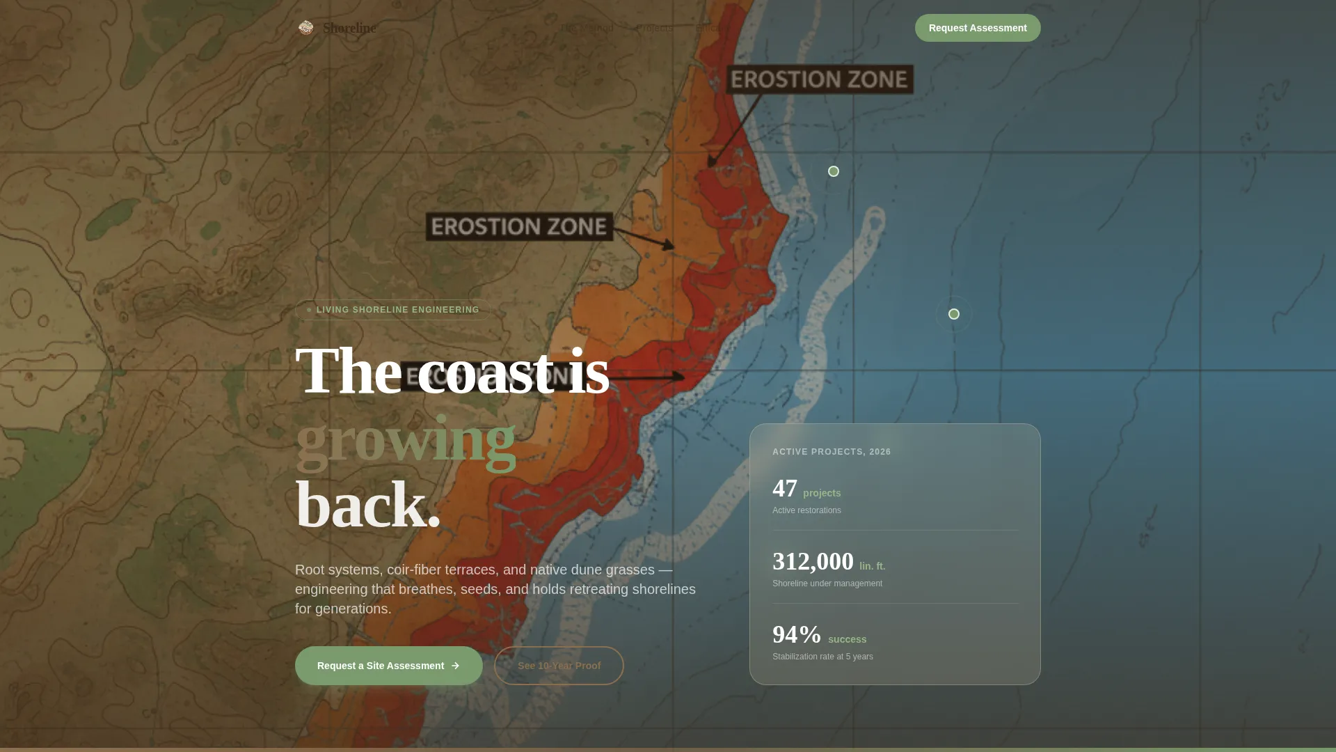
- An aerial map hero with pulsing project pins, labeled site data, and a slow coastal pan animation
- A dual lead capture module with a site assessment form and a gated efficacy report download
Feature list
This template ships with six core feature systems. Each one is built specifically for the audience, the subject matter, and the B2B conversion goal described in the project brief.
Aerial Map Hero with Pulsing Project Pins
The header renders a warm-stone coastal survey map with visible contour lines. Three to four project pins pulse gently in sage green, each carrying a date and a recovery metric such as "Outer Banks, 2019, 14 m reclaimed." A slow north-coast pan connects the pins like chapters in a recovery story. Visitors read the proof before they read a single line of copy.
Scroll-Linked Decade Timeline
Scrolling moves the visitor forward through the life of one shoreline project, year by year. Raw erosion photography and loss metrics anchor Year 0. Engineering plan overlays follow. Installation imagery shows crews laying coir rolls and planting American beachgrass plugs. Each subsequent section advances one year, using the same camera angle as vegetation thickens and the bluff face greens over. The scroll itself becomes the evidence.
Living Shoreline Method Section
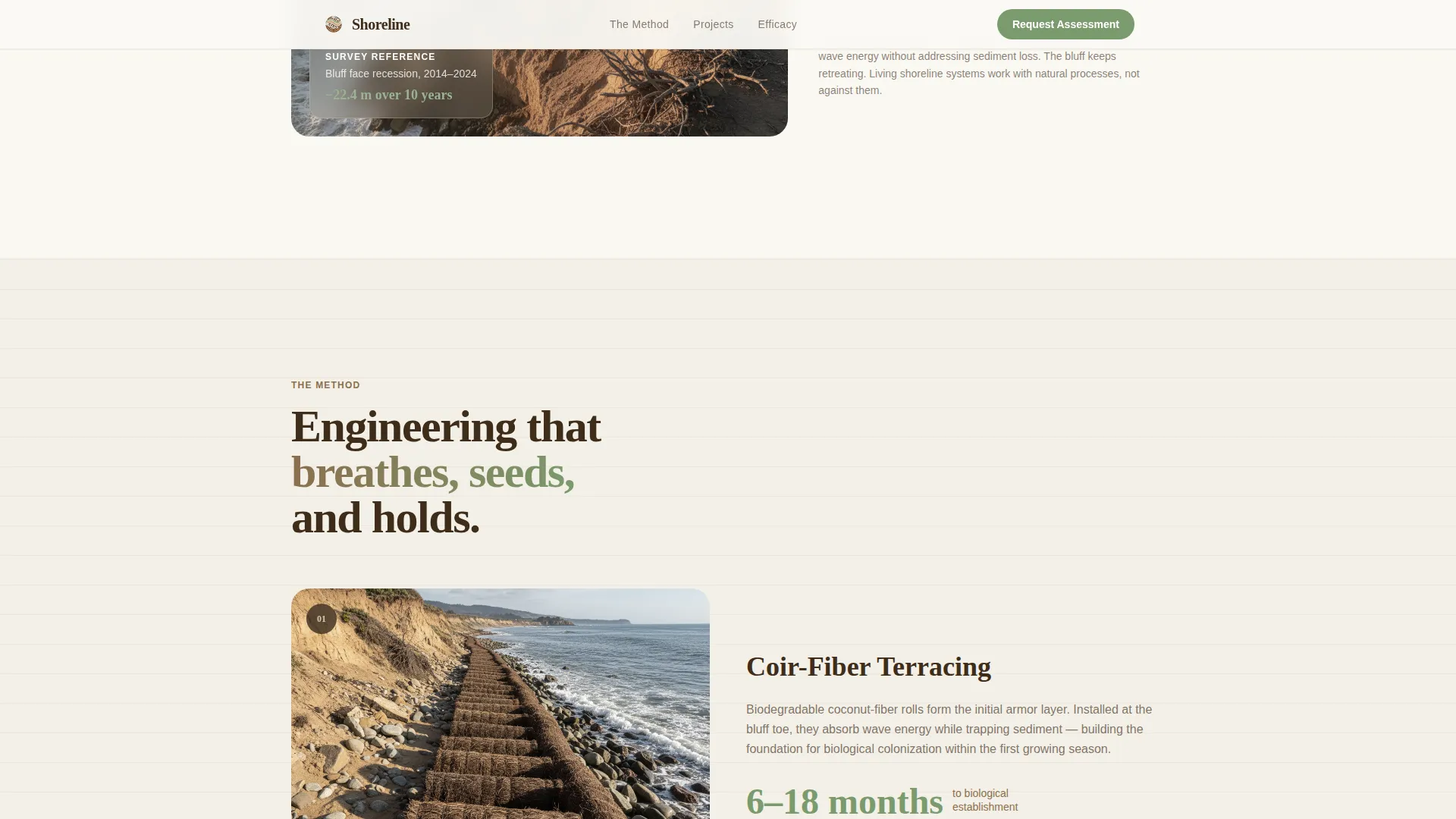
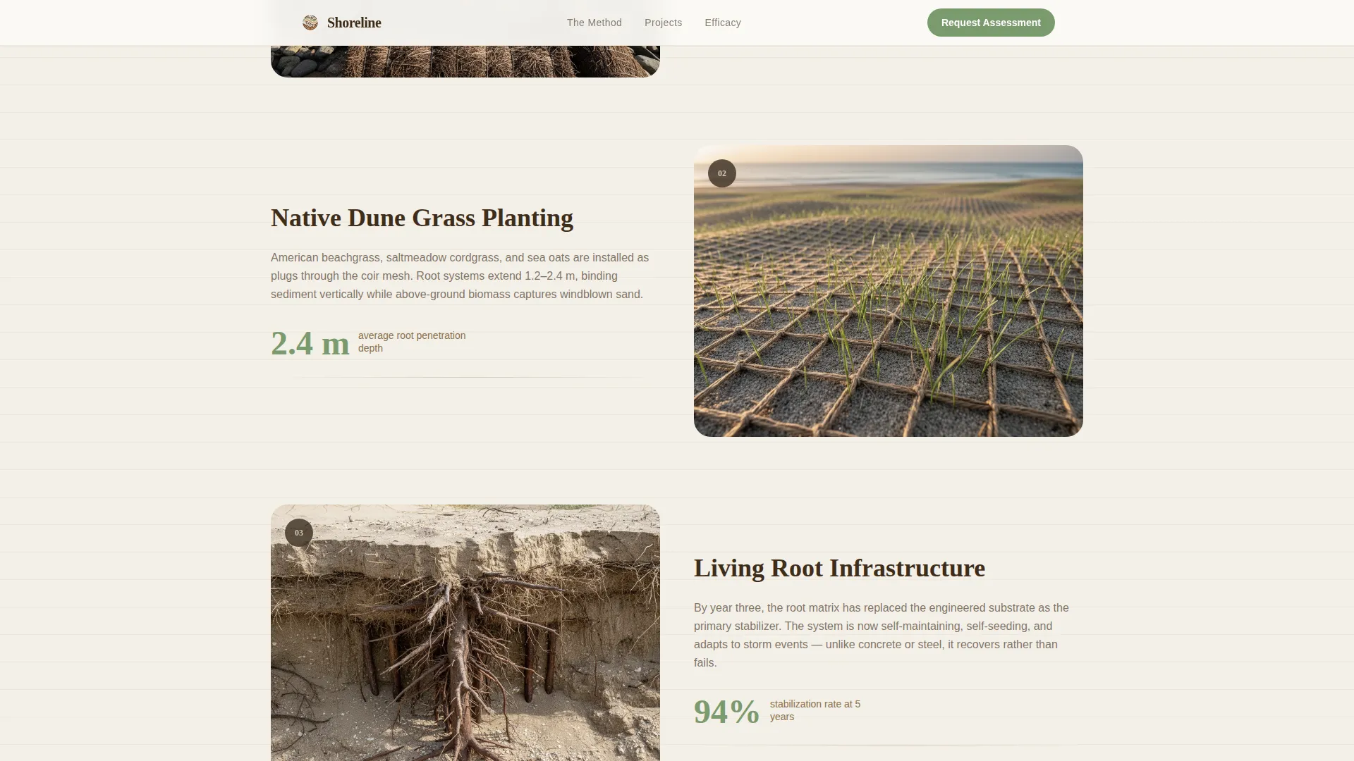
A dedicated section explains the engineering approach behind coir-fiber terraces, native dune grasses, and living root systems. Visitors see how the intervention is structured before they are asked to act. This section bridges the emotional impact of the timeline with the technical credibility institutional buyers require.
Dual-Path Lead Capture Module
The primary call to action, "Request a Site Assessment," collects agency or organization name, project coastline length in linear feet, a jurisdiction type dropdown (municipal, federal, or private), and an optional field for attaching a GIS shapefile or survey document. A secondary path, "Download the 10-Year Efficacy Report," gates a detailed PDF behind a work email field. Both paths appear in the closing module, with the primary call to action also appearing after the third timeline section.
Warm Stone Color System and Garden Growth Typography
The palette moves through sun-bleached sandstone (#D6C6A5), wet clay (#8B6F4E), deep root-zone brown (#3E2C1A), and new-growth sage (#7A9A6D). Sage is reserved for every clickable surface and call-to-action element. Fraunces serif handles display headings, while DM Sans carries all body text. The typographic pairing reinforces the contrast between deep-rooted authority and clean readability.
Single-Row Footer Pattern
The footer uses a clean linear single-row layout. It keeps the closing module uncluttered and ensures the final impression of the page stays aligned with the calm, authoritative tone of the rest of the experience.
Page sections overview
| Section | Purpose |
|---|---|
| Hero Aerial Map | Opens the page with a survey-map visual, pulsing project pins, and a slow coastal pan that shows recovery proof before any copy |
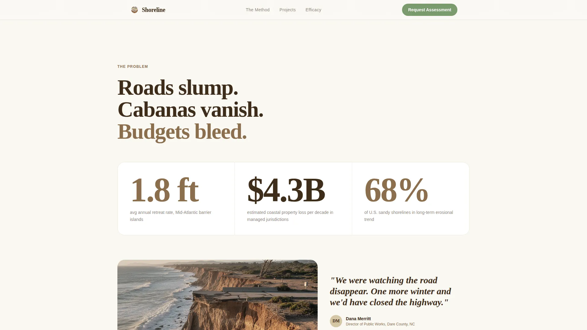
| The Problem | Presents raw erosion photography and large-type loss metrics to frame the scale of what institutional clients are facing |
| The Method | Explains the coir-fiber terrace, native grass, and living root-system engineering approach in clear, credible terms |
| Timeline Year Zero | Shows the starting state: survey data, loss measurements, and pre-intervention site conditions |
| Timeline Progression | Advances year by year through the same camera angle as vegetation establishes and sediment accretes |
| Primary call to action Block | Surfaces the "Request a Site Assessment" form after the third timeline section for ready-to-act buyers |
| Efficacy Report Gate | Offers the gated 10-Year Efficacy Report PDF to earlier-stage leads via a work-email capture modal |
| Closing call to action Module | Anchors both lead capture paths together at the bottom of the page for a final conversion opportunity |
| Single-Row Footer | Closes with a minimal linear footer that keeps the experience clean and professional |
Design & branding system
The visual identity follows a Garden and Growth theme expressed through the Warm Stone color system. Every color in the palette corresponds to a physical layer of a stabilized dune cross-section, so the design itself reinforces the subject matter.
- Backgrounds alternate between sandstone (#D6C6A5) and white, with thin clay-brown (#8B6F4E) rules as section dividers
- Body text sits in root-zone brown (#3E2C1A) for depth and legibility, while sage (#7A9A6D) activates on every button and interactive element
- Fraunces serif display headings pair with DM Sans body text, giving the page both botanical warmth and institutional clarity
Mobile & speed optimization
The template is designed desktop-first, matching the primary audience of GIS users and public-works directors who work on larger screens. All scroll-linked animations and timeline interactions are built with that context in mind.
- Server Components handle static content sections for faster initial rendering, while Client Components manage the animated timeline and interactive form elements
- The timeline scrubber, pulsing pin animations, and PDF gate modal are all built as isolated interactive layers, so they do not interfere with the load performance of surrounding static sections
- The layout adapts to smaller screens without losing the core narrative sequence of the decade timeline
How this template helps you convert
The conversion strategy in this template is built on evidence accumulation. By the time a visitor reaches any call-to-action element, they have already watched a coastline recover across a decade of scroll-driven proof. The ask feels earned, not premature.
- The aerial map hero and project pins establish credibility instantly. Named sites with dates and recovery metrics replace generic claims with verifiable outcomes before the visitor reads a headline.
- The scroll-linked timeline turns passive reading into an immersive experience. Each year forward builds confidence in the method, so the "Request a Site Assessment" form arrives at the moment of highest trust.
- The dual-path lead capture serves two buyer speeds simultaneously. Decision-makers who are ready to act fill out the assessment form. Those who need internal approval first download the efficacy report, staying in the funnel at their own pace.
Other information about this template
This template is built specifically for the coastal erosion management niche within the broader Agriculture and Environment category, under the Soil and Water Conservation subcategory. It is designed for a USA-based audience using imperial units throughout, including linear feet for coastline measurement and USD for any budget-context references.
- The template style is Single Column Flow, keeping the narrative linear and preventing visitors from skipping the timeline proof
- The creative direction is Timeline Progression, a format that makes the restoration journey the central persuasion mechanism rather than a supporting element
- The header concept is Map-Based, using real coastal survey aesthetics to signal technical authority from the first frame
- Animation intensity is high by design, with scroll-linked reveals, pulsing pins, a pan animation, and staggered section transitions all working in coordination
- The landing page direction is Partnership and B2B, meaning every structural decision prioritizes institutional trust over consumer-style urgency
Theme
Garden & Growth
Creative direction
Timeline Progression
Color system
Warm Stone
Style
Single Column Flow
Direction
Partnership/B2B
Page Sections
Aerial Map Hero with Pulsing Project Pins
Scroll-linked Decade Timeline
Living Shoreline Method Section
Dual-path Lead Capture Module
Warm Stone Color and Typography System
Single-row Footer Layout
Related questions
Who is this landing page template designed for?
Can I adapt the timeline sections for a different project or site?
What does the dual lead capture setup include?
Is this template suited to public-sector or federal procurement contexts?
What typography and colors come pre-applied in this template?